16 Jun Roadside America in a Story Map
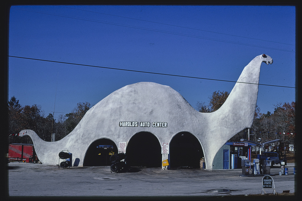
The Library of Congress houses the John Margolies Roadside America Photograph Archive. That archive contains nearly 12,000 photographs of interesting roadside attractions all over the United States and eastern Canada. The collection includes pictures of things like gas stations shaped like a dinosaur, windmills that serve as ice cream stands, funky miniature golf courses, and lots of neon signs for motels and restaurants.
Recently, the Library of Congress published an ESRI Story Map of photographs in the John Margolies Roadside America Photograph Archive. The map is titled Roadside America. You can view the images on an interactive map or simply scroll through some curated collections of images from the collection. I found it fun to click on the markers on the map to discover some roadside attractions in my home state as well as others around the country. But before you head out on the road to look for them I should point out that many of the photographs are of things that are no longer out on the roadside.
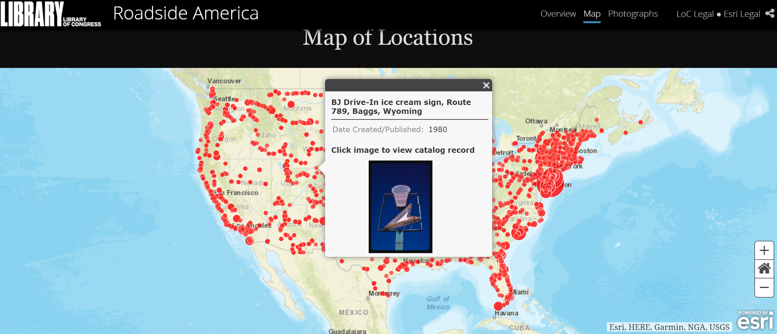
As you click through the Roadside America map you will be able to click-through to the LOC pages that host the images. There you can download the images in various sizes. The images are free for re-use. Image record and citation information is available on each page on which the images are hosted.
Applications for Education
Roadside America provides a nice way for students to discover some pieces of Americana past and present. I’d use the map as a way to spark students’ curiosity to conduct a little research about some of these interesting roadside attractions. I might also use the map as a model for having students create their own roadside attractions maps of places in their home states that they may have seen and or taken pictures of.
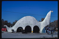
The Library of Congress houses the John Margolies Roadside America Photograph Archive. That archive contains nearly 12,000 photographs of interesting roadside attractions all over the United States and eastern Canada. The collection includes pictures of things like gas stations shaped like a dinosaur, windmills that serve as ice cream stands, funky miniature golf courses, and lots of neon signs for motels and restaurants. Recently, the Library of Congress published an ESRI Story Map of photographs in the John Margolies Roadside America Photograph Archive. The map is titled Roadside America. You can view the images on an interactive map or simply scroll through some curated collections of images from the collection. I found it fun to click on the markers on the map to discover some roadside attractions in my home state as well as others around the country. But before you head out on the road to look for them I should point out that many of the photographs are of things that are no longer out on the roadside. As you click through the Roadside America map you will be able to click-through to the LOC pages that host the images. There you can download the images in various sizes. The images are free for re-use. Image record and citation information is available on each page on which the images are hosted. Applications for Education Roadside America provides a nice way for students to discover some pieces of Americana past and present. I’d use the map as a way to spark students’ curiosity to conduct a little research about some of these interesting roadside attractions. I might also use the map as a model for having students create their own roadside attractions maps of places in their home states that they may have seen and or taken pictures of. H/T to Maps Mania. Featured image credit: Margolies, John, photographer. Harold’s Auto Center, horizontal view, Sinclair gas station, Route 19, Spring Hill, Florida. Photograph. Retrieved from the Library of Congress, www.loc.gov/item/2017702118/ digital maps, ESRI, Free Technology For Teachers, Geography, History, how to, Roadside America, Social Studies, U.S. History, united states historyRead More
Sorry, the comment form is closed at this time.