01 Jan How to Create Map Overlays
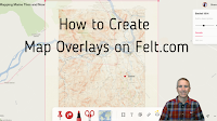
Felt was one of my favorite new tools in 2022. In fact, I liked it so much that I included it in my Best of the Web for 2022. Felt is a free multimedia mapping tool that I think is easier for first-time users to use than Google’s My Maps or ESRI’s mapping tools. Right at the end of the year Felt added some new features including new base maps and an updated image overlay feature which I demonstrate in this short video.
The image overlay feature on Felt can be used to overlay historic maps on current maps. You can adjust the transparency of the overlay to easily compare past and present views of roads, buildings, and landmarks. The updated version of Felt lets you use image files as well as PDFs as overlays. Watch the video that is embedded below to see how it works.
Video – How to Create Map Overlays on Felt.com
Learn more about Felt in the following blog posts and videos:
- Felt – A New Way to Create Multimedia Maps
- Two Cool Mapping Tools in the Felt Mapping Platform
- New Base Map Options on Felt
Are you a tech coach or media specialist looking for some new ideas to share with your colleagues? If so, 50 Tech Tuesday Tips is an eBook you need. You can get it right here.
Felt was one of my favorite new tools in 2022. In fact, I liked it so much that I included it in my Best of the Web for 2022. Felt is a free multimedia mapping tool that I think is easier for first-time users to use than Google’s My Maps or ESRI’s mapping tools. Right at the end of the year Felt added some new features including new base maps and an updated image overlay feature which I demonstrate in this short video. The image overlay feature on Felt can be used to overlay historic maps on current maps. You can adjust the transparency of the overlay to easily compare past and present views of roads, buildings, and landmarks. The updated version of Felt lets you use image files as well as PDFs as overlays. Watch the video that is embedded below to see how it works. Video – How to Create Map Overlays on Felt.comLearn more about Felt in the following blog posts and videos: Felt – A New Way to Create Multimedia MapsTwo Cool Mapping Tools in the Felt Mapping PlatformNew Base Map Options on Felt
Are you a tech coach or media specialist looking for some new ideas to share with your colleagues? If so, 50 Tech Tuesday Tips is an eBook you need. You can get it right here. digital mapping, Felt, Free Technology For Teachers, Geography, GIS, Google My Maps, History, how to, Mapping, Science, Social StudiesRead More


Sorry, the comment form is closed at this time.