
17 Aug An Interactive Map of Historical Sites in Every U.S. State

The Traveling Salesman Problem is a website developed by William Cook at the University of Waterloo. The site features interactive maps that chart the short distance between a series of places. One of those maps is of all of the places in the United States National Register of Historic Places, all 49,603 of them.You can view the whole country in one map or visit each state’s individual map.
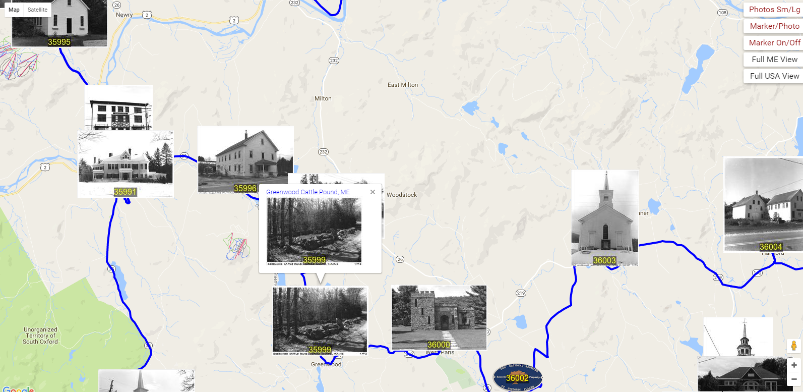
Naturally, I jumped to the map of Maine’s historic places to see how many I was familiar with. One that’s close to my home is this old cattle pound that I often stop at while riding my bike in the summer. I clicked on the image on the map and was able to click through to the asset detail provided by the National Parks service. The asset detail includes when the site was added to the national registry and why it is significant.
Applications for Education
These maps of the National Register of Historic Places could be useful assets for teachers developing lessons on state history. You might ask students to look at the images and try to determine the significance of the sites before looking at the site asset details.The Traveling Salesman Problem is a website developed by William Cook at the University of Waterloo. The site features interactive maps that chart the short distance between a series of places. One of those maps is of all of the places in the United States National Register of Historic Places, all 49,603 of them.You can view the whole country in one map or visit each state’s individual map.Naturally, I jumped to the map of Maine’s historic places to see how many I was familiar with. One that’s close to my home is this old cattle pound that I often stop at while riding my bike in the summer. I clicked on the image on the map and was able to click through to the asset detail provided by the National Parks service. The asset detail includes when the site was added to the national registry and why it is significant.Applications for EducationThese maps of the National Register of Historic Places could be useful assets for teachers developing lessons on state history. You might ask students to look at the images and try to determine the significance of the sites before looking at the site asset details. Free Technology For Teachers, Geography, History, Interactive Maps, Mapping, Maps, Social StudiesRead More
Sorry, the comment form is closed at this time.