
23 May A Good Way for Students to Visually Compare the Sizes of Countries and States
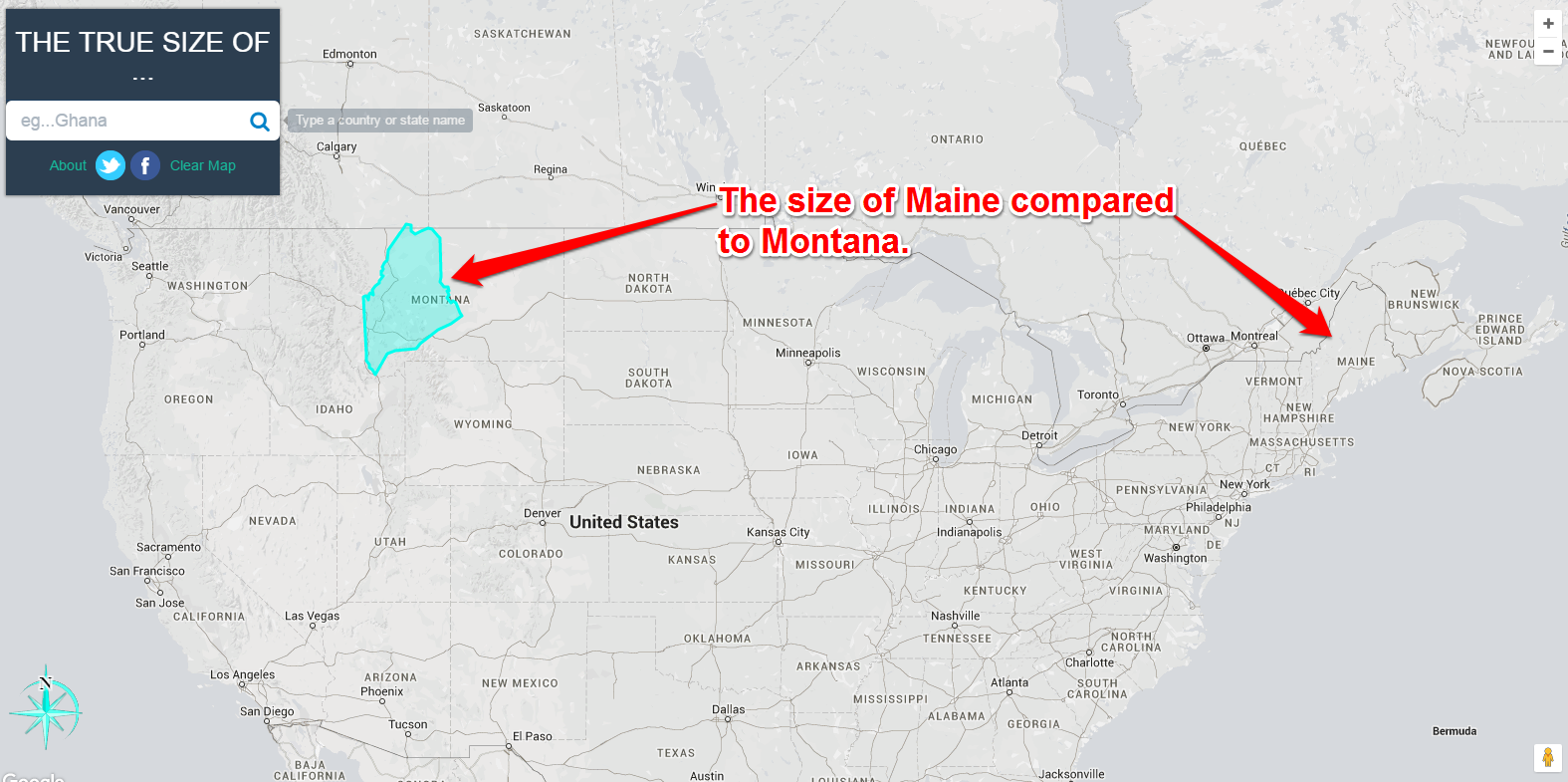
My students here in Maine always think of our state as being a big place and it is big in relation to the rest of New England. Compared to our friends in the west, Maine is a small place. Similarly, they sometimes have trouble understanding the size of the lower 48 states compared to Canada. The following tool can help students understand the size of their countries and states in relation to others.
The True Size Of… is a free web tool that lets you quickly compare the size of two countries or two states within the United States. To compare two countries simply enter one into the search box then enter a second one into the search box. Both countries will be highlighted for you. You can then drag and drop one onto the other. The same can be done with states of the United States as is demonstrated in my screenshot below.
Learn how to make more money this year by creating and selling your own digital products. Enroll in How to Create & Sell Your Own Digital Products today!
My students here in Maine always think of our state as being a big place and it is big in relation to the rest of New England. Compared to our friends in the west, Maine is a small place. Similarly, they sometimes have trouble understanding the size of the lower 48 states compared to Canada. The following tool can help students understand the size of their countries and states in relation to others.
The True Size Of… is a free web tool that lets you quickly compare the size of two countries or two states within the United States. To compare two countries simply enter one into the search box then enter a second one into the search box. Both countries will be highlighted for you. You can then drag and drop one onto the other. The same can be done with states of the United States as is demonstrated in my screenshot below.
Learn how to make more money this year by creating and selling your own digital products. Enroll in How to Create & Sell Your Own Digital Products today! Free Technology For Teachers, Geography, how to, Maps, Social StudiesRead More
Sorry, the comment form is closed at this time.